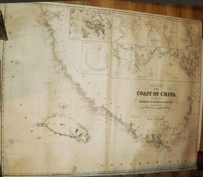
Chart of the Coast of China Extending from Hong Kong to the River Yang-Tse.
Chart.
James Imray and Son, ( 1868), London
Blueback chart edged in linen, 51 x 39 3/4 inches.
Price: $1000
This is an early state of a scarce and important chart. “With plans on a large scale of the principal harbours, etc.” These insets are Woosang River, Chusan Archipelago, Yang-Tse Kiang, Amoy Harbor, Hoo-E-Tow & Chimmo Bays, Tong-Sang Harbor, Pratas Reef, and a fine early chart of Hong Kong. With soundings, and lights marked in red. Course plotted in pencil along the entire coast. Some edge tears and soiling, old closed tear along left edge. generally in very good condition.
Return to China!
